




The DJI Zenmuse L3 is a long-range aerial LiDAR payload for large-area survey work. It combines a 1535 nm LiDAR, two 100 MP RGB mapping cameras, a high-precision POS system and a 3-axis gimbal in one compact unit. It suits surveyors, utilities and corridor mapping teams.
Supplied with DJI Care Enterprise Plus. Aircraft sold separately.
950 m LiDAR range
A 1535 nm LiDAR that reaches up to 950 m, for efficient capture on large and complex sites.
Dual 100 MP cameras
Two RGB mapping cameras capture imagery alongside the LiDAR in the same flight.
Up to 100 km² a day
High daily coverage for very large mapping projects.
High-precision POS
An integrated POS system for faster acquisition and survey-grade accuracy.
High penetration
Designed to capture useful data through vegetation and difficult surfaces.
Capture to delivery
Part of DJI’s geospatial workflow, from airborne capture through processing to finished outputs.
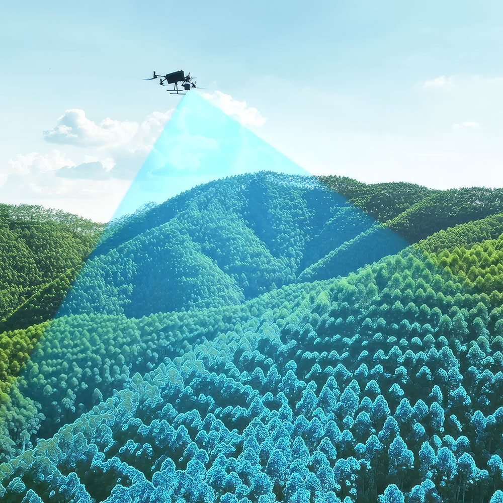
DJI Zenmuse L3
Long-range LiDAR
The Zenmuse L3 is DJI’s first long-range, high-accuracy aerial LiDAR system. Its 1535 nm LiDAR reaches up to 950 m, so each flight covers more of a large or complex site.
1535 nmLiDAR wavelength
950 mMax LiDAR range
100 km²Coverage per day
High penetration
Built to capture usable points through vegetation and more difficult surfaces, where point cloud quality matters most.
Made for big projects
Range, camera resolution and daily output suit large-area surveying, corridor work and utilities.
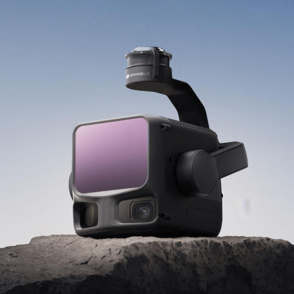
DJI Zenmuse L3
Two 100 MP mapping cameras
Two high resolution RGB mapping cameras sit beside the LiDAR. Imagery and point cloud come from the same flight, which gives you richer deliverables without a second mission.
LiDAR and imagery in one pass
No separate camera flight to plan, fly and line up afterwards.
More detail in the outputs
RGB data adds visual detail to LiDAR deliverables for clients and engineers.
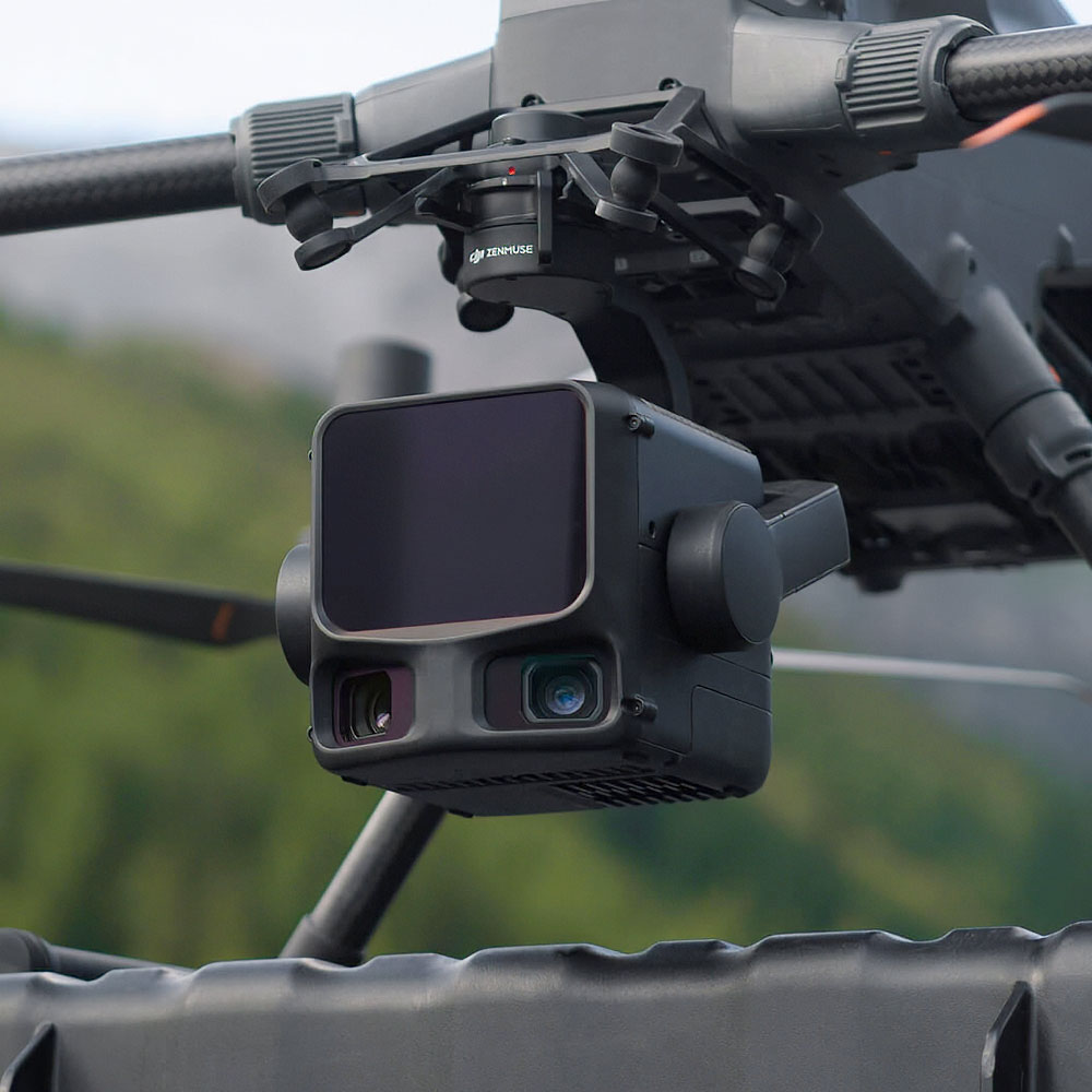
DJI Zenmuse L3
Compact, integrated and accurate
Everything the L3 needs for survey-grade capture is built into one payload. The high-precision POS system ties the LiDAR and camera data to accurate positions.
High-precision POS
The integrated POS system speeds up data acquisition and supports dependable survey accuracy.
One unit to mount
LiDAR, dual RGB cameras, POS and a 3-axis gimbal in a single compact payload, which keeps deployment simple.

DJI Zenmuse L3
Built for daily output
The L3 is designed around how much ground you can cover in a day. DJI’s workflow then carries the data from capture through to finished geospatial outputs.
Up to 100 km² per day
Daily coverage of up to 100 square kilometres for very large mapping workloads.
Capture to delivery
Part of DJI’s geospatial workflow, so the route from flight to finished deliverable is already worked out.
Key specs
DJI Zenmuse L3
| LiDAR wavelength | 1535 nm |
|---|---|
| Max LiDAR range | Up to 950 m |
| RGB mapping cameras | 2 × 100 MP |
| Positioning | High-precision POS system |
| Gimbal | 3-axis |
| Coverage | Up to 100 km² per day |

See the DJI Zenmuse L3 up close
Talk to us about a demo, a site assessment or pricing.
Get in touch to discuss a demo
Incredible Group is an Authorised DJI Enterprise reseller.
All specs on this page are DJI’s published figures and subject to change by the manufacturer. Please always check DJI’s own product page for up to date information.