FLYABILITY Elios 3

Indoor inspection, mapping and specialist payload drone for inaccessible spaces.

FLYABILITY Elios 3

Indoor inspection, mapping and specialist payload drone for inaccessible spaces.

FLYABILITY Elios 3 is a collision-tolerant indoor drone for inspecting, mapping and digitising confined or hard-to-reach environments. Built around LiDAR, visual inspection tools and modular payload options, it helps teams collect actionable data while keeping people out of hazardous spaces.

Confined-space access

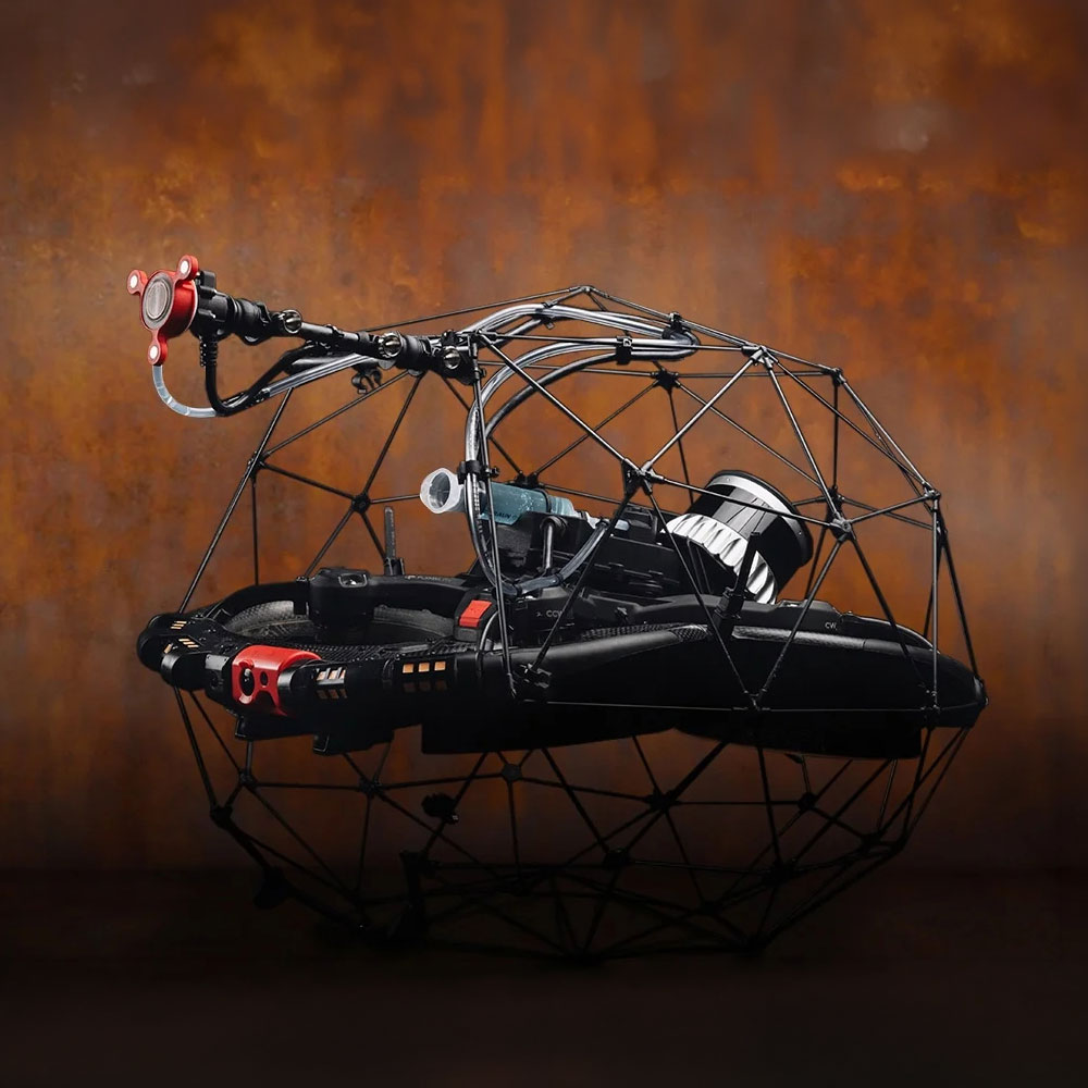
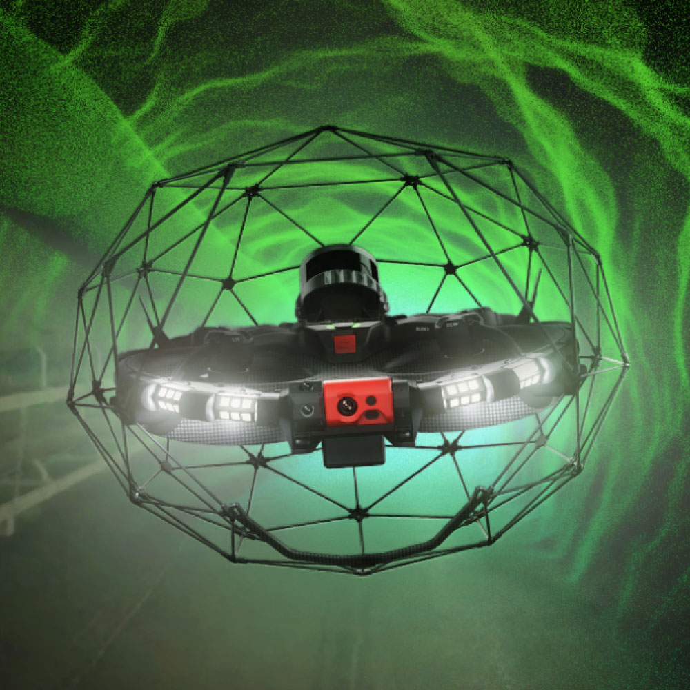
Protected by a collision-tolerant cage, Elios 3 can enter complex indoor spaces where people, ground robots or conventional drones cannot safely operate.

Live 3D awareness

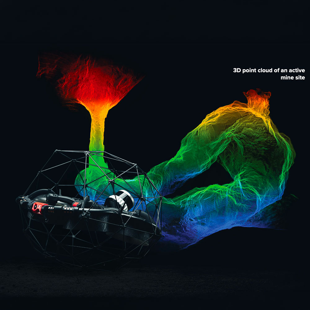
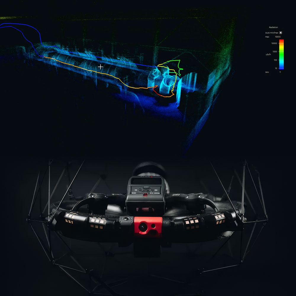
On-board LiDAR and FlyAware mapping give pilots spatial awareness while capturing inspection data inside complex assets.

Modular payload platform

Specialist payloads expand Elios 3 from visual inspection into surveying, mapping and radiation detection workflows.

Reduced human exposure

Teams can inspect hazardous, elevated or contaminated areas remotely, reducing the need for scaffolding, rope access or direct entry.

Actionable digital records

Inspection flights create visual, spatial and sensor data that can support reporting, planning and asset documentation.

Built for industrial reality

Designed for demanding indoor environments including mines, tanks, tunnels, sewers, power assets and process facilities.

Digitising the inaccessible

Elios 3 combines a protective cage, LiDAR-based spatial awareness and industrial inspection tools to help teams safely collect data inside confined, hazardous or hard-to-access assets.

Collision-tolerant design

The protective cage and flight-control design allow the drone to remain stable after contact, helping pilots work close to structures in complex indoor spaces.

LiDAR-assisted flight

Live 3D mapping improves pilot awareness and supports more structured inspection inside GPS-denied environments.

Inspection-ready data

Visual, thermal, LiDAR and payload data can be reviewed and used to support maintenance planning and asset understanding.

Surveying Payload

The Elios 3 Surveying Payload turns the platform into a flying mobile scanner for high-resolution 3D data capture in hard-to-reach environments, including tunnels, culverts, sewers and mines.

Centimetre-grade mapping

The Ouster OS0-128 Rev 7 LiDAR sensor and FARO Connect SLAM workflow support detailed point clouds, georeferencing and survey-grade mapping outputs.

Efficient data capture

The payload can capture high-density LiDAR data in areas that would otherwise require slow, manual or risky survey methods.

RAD Payload

The Elios 3 RAD Payload adds Mirion-powered radiation detection and localisation, allowing teams to assess radiological conditions remotely while keeping personnel outside hazardous areas.

Remote radiation surveying

Operators can collect radiation readings inside indoor spaces without sending people directly into potentially contaminated or high-dose areas.

3D localisation of dose fields

Radiation data can be associated with the drone trajectory and 3D map, helping teams identify hotspots and plan safer interventions.

Industrial applications

Elios 3 supports inspection, survey and safety workflows across infrastructure, energy, mining, utilities, maritime, nuclear and public-safety environments.

Safer inspections

By sending the drone into confined or hazardous areas first, teams can reduce direct exposure, improve planning and limit unnecessary site risk.

Better asset understanding

The combination of visual inspection, LiDAR mapping and specialist payload data gives teams a clearer picture of conditions inside complex assets.
Disclaimer

All above specs are subject to change by the original manufacturer. Please always consult the actual product’s page on the original manufacturer’s website for up to date information and data notes

Filters

Product Category
Product Category
Brand
Brand
Industry
Industry
Capability
Capability