
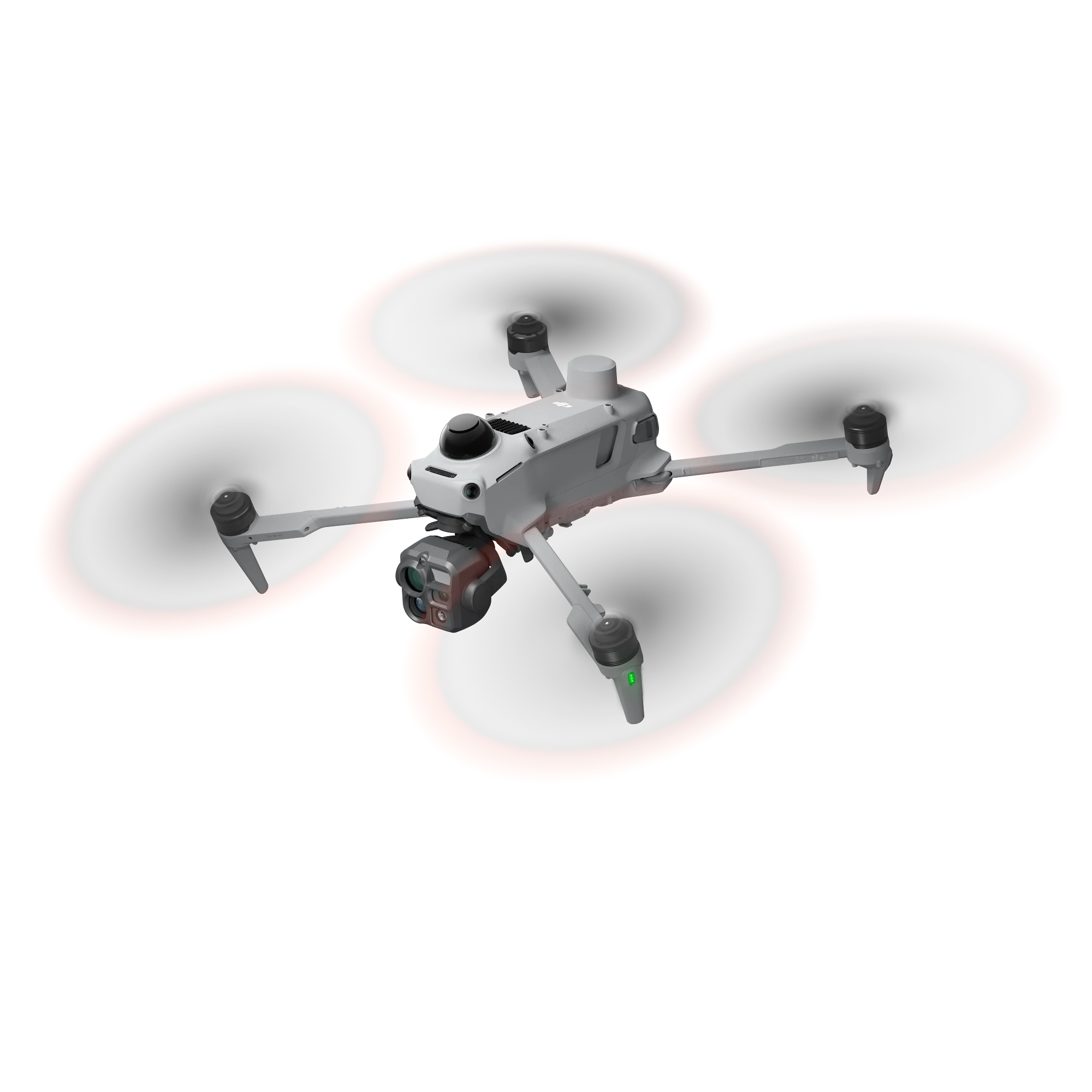

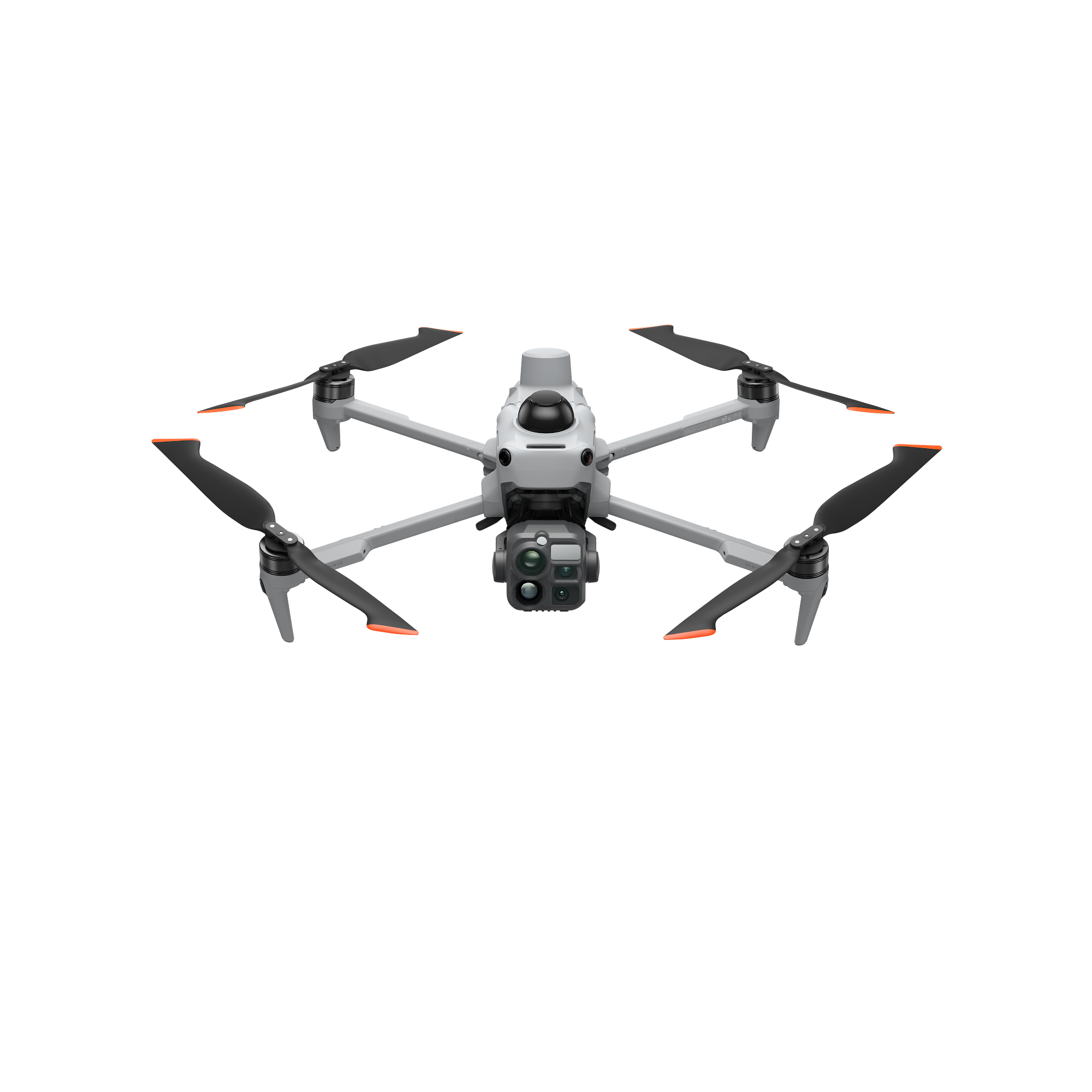





The DJI Matrice 5T is a compact enterprise drone for teams that work day and night, in poor weather and close to infrastructure. It carries a 1280 × 1024 thermal camera, three visible cameras, a 3 km laser rangefinder and an NIR illuminator, with LiDAR, mmWave radar and full-colour vision for obstacle sensing. Up to 59 minutes in the air and an IP55 rating make it a strong fit for search and rescue, utilities, inspection and surveying in New Zealand conditions.
Key features
- Native 1K thermal A 1280 × 1024 thermal sensor, four times the pixels of a 640 × 512 camera, with an ultra-high-resolution mode at 2560 × 2048.
- Colour at night A large 1/0.98-inch f/1.8 wide camera and AI low-light processing keep imagery in colour down to around 0.01 lux.
- Two 50 MP zoom cameras 3× medium tele for close inspection detail and 11× tele (176× hybrid) for reading plates or signage from a distance.
- Sees wires, rain or shine LiDAR picks up power lines at up to 32 m, mmWave radar works through fog, rain and dust, and omnidirectional vision covers the rest.
- 59 minute flight time A 215 Wh battery, 23 m/s top speed and a 10 second power-on to take-off for time-critical call-outs.
- AI on the aircraft More than 20 built-in detection types, support for third-party models, AI patrol routes and FlightHub 2 search by text or image.
Built for search and response
 Thermal and visible feeds can be fused on the controller, with up to three feeds side by side. The laser rangefinder marks positions, lines and areas out to 3 km, and the NIR light adds up to 100 m of illumination for the tele camera’s monochrome night mode. Built-in ADS-B and Remote ID receivers flag nearby manned and unmanned aircraft.
Safer near lines and structures
 The Matrice 5T is the first DJI compact enterprise drone to combine LiDAR, mmWave radar and omnidirectional vision. It can lock onto conductors and fly alongside them for line inspection, and it fuses vision and radar to hold position under bridges and in deep valleys where GNSS is weak. It’s rated IP55 and operates from −20°C to 50°C.
Longer reach, more ways to fly
 O4 Enterprise Enhanced transmission reaches up to 40 km where regional radio rules allow, with two built-in cellular dongles for backup links. Relay modes let one aircraft extend the link for one or two others. The Matrice 5T can also launch from a moving vessel and land back on a marked deck.
Survey and model on site
 With DJI Terra, the Matrice 5T delivers centimetre-level survey accuracy without ground control points, and it can build 2D thermal orthomosaics for solar and grid work. Point clouds and 2.5D models can be generated on the controller during the flight for quick measurement on site.
Pricing and availability in New Zealand are confirmed on enquiry. Talk to our team about a demo, kit options and DJI Care Enterprise cover.