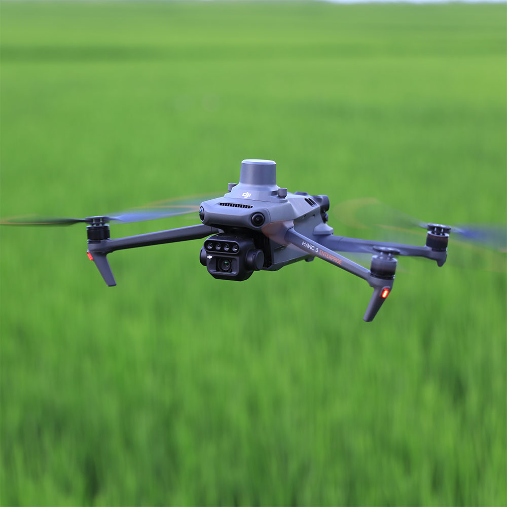
DJI Mavic 3M is a compact multispectral drone built for precision agriculture and crop intelligence workflows. Combining a 20 MP RGB camera with a four-band multispectral camera array, it is designed to capture the data needed for crop monitoring, growth analysis, and more informed agricultural decision-making while remaining portable and easy to deploy in the field.
RGB And Multispectral Imaging
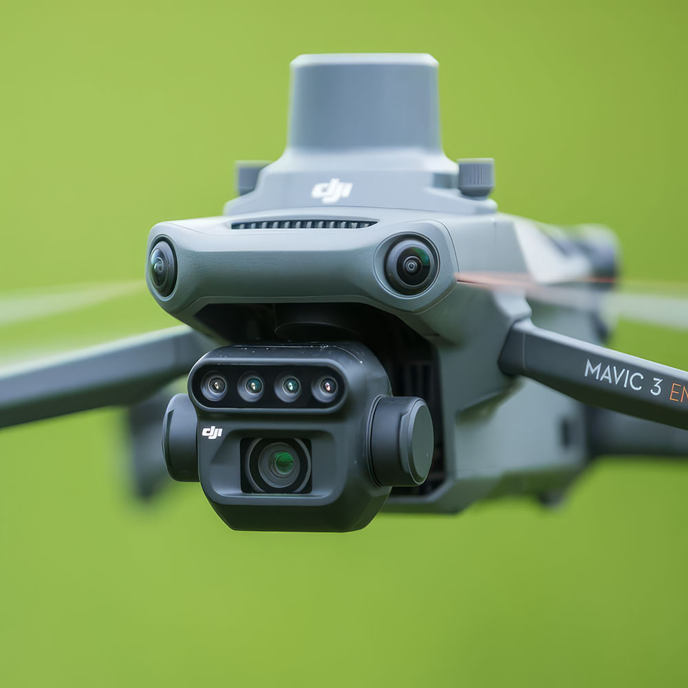
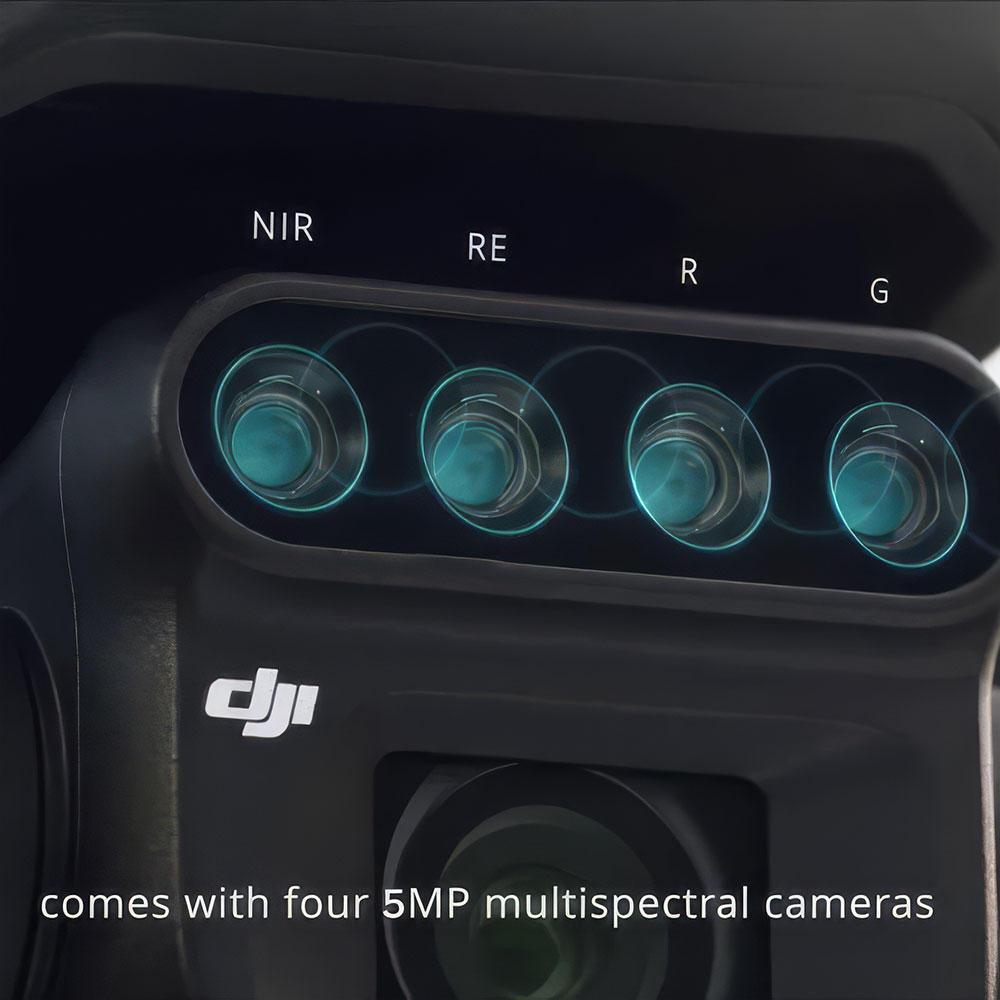
Combines a 20 MP RGB camera with a four-band multispectral system for clearer crop and vegetation analysis.
Compact And Portable
Foldable design makes it easy to carry, deploy, and use across routine field operations.
Precision Mapping
Mechanical shutter and RTK support help deliver accurate low-altitude surveying and mapping results.
Crop Intelligence Workflow
Supports crop monitoring, growth analysis, and prescription-map creation for better agricultural decisions.
43-Minute Flight Time
Long flight endurance helps cover more ground per mission with fewer interruptions.
See More, Work Smarter
Built to turn aerial crop data into practical insight for precision agriculture and field planning.
Precision crop insight from the air
DJI Mavic 3M is a compact multispectral drone built for precision agriculture, helping growers and agronomy teams capture clearer crop data for monitoring, analysis, and better-informed field decisions.
RGB and multispectral imaging
The system combines a 20 MP RGB camera with a four-band multispectral array to deliver both visual and crop-analysis data in one flight.
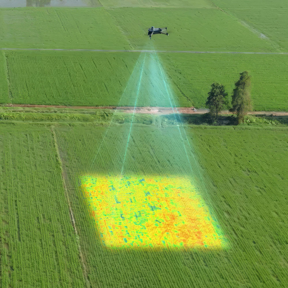
Crop health analysis
It is designed to support vegetation analysis, growth assessment, and clearer understanding of crop conditions across the field.
Prescription map workflow
Captured data can support more informed planning and treatment decisions by turning aerial field information into actionable insight.
Portable and practical in the field
Mavic 3M is positioned as a highly deployable agricultural tool, giving teams serious data capability without the size and complexity of a larger platform.
Compact deployment
Its foldable, lightweight design makes it easier to carry, launch, and use across routine field operations.
43-minute flight time
Long flight endurance helps operators cover more ground per mission with fewer interruptions.
Built for accurate data collection
Beyond portability, the platform is designed to deliver reliable mapping and survey performance for agricultural workflows where accuracy matters.
Mechanical shutter
A mechanical shutter helps reduce image distortion and supports cleaner low-altitude surveying and mapping results.
RTK precision
RTK support strengthens positioning accuracy for more dependable mapping, reconstruction, and field-analysis workflows.
Smarter decisions, clearer results
DJI Mavic 3M is built to help turn aerial crop data into practical day-to-day value, making precision agriculture more accessible and easier to apply.
Field scouting support
The platform helps growers and service providers scout crops more efficiently and identify issues earlier across larger areas.
See more, work smarter
By combining portability, multispectral imaging, and mapping precision, Mavic 3M gives teams a more effective tool for modern crop intelligence.
Disclaimer
All above specs are subject to change by the original manufacturer. Please always consult the actual product’s page on the original manufacturer’s website for up to date information and data notes