DJI Terra

The World, Your Digital Asset

DJI Terra

The World, Your Digital Asset

DJI Terra is a 3D reconstruction software platform designed to turn drone-captured data into accurate 2D and 3D digital models. Built around next-generation reconstruction technologies including 3D Gaussian Splatting, it supports visible-light, LiDAR, and multispectral workflows while working closely with DJI drones to create a unified capture, processing, and application pipeline.

The World, Your Digital Asset

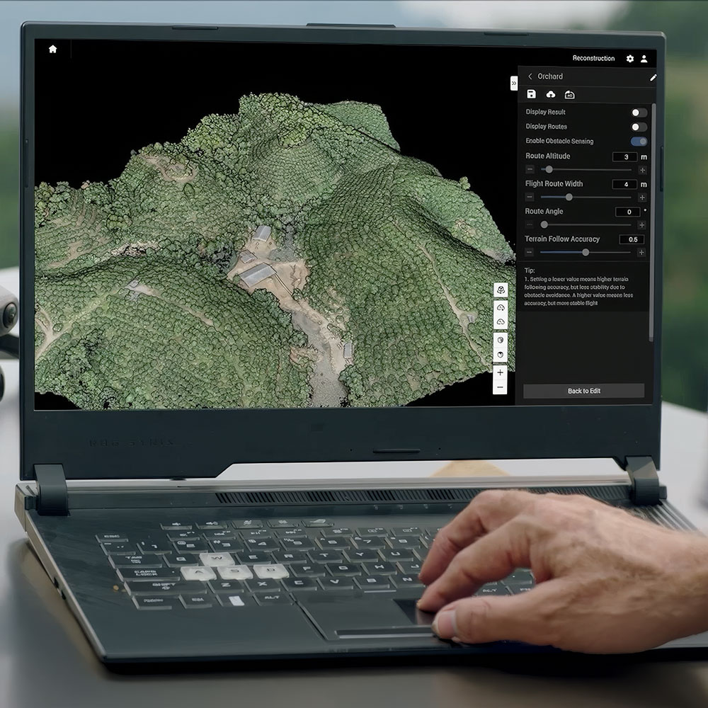
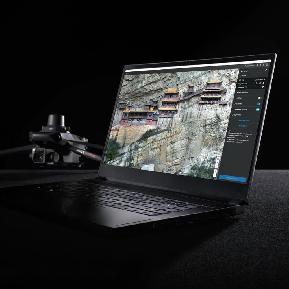
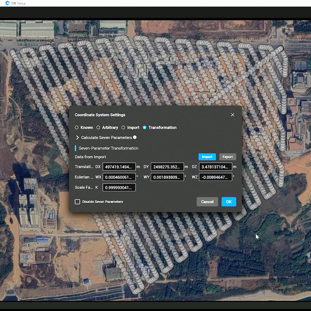
Built to turn drone-captured data into practical 2D and 3D digital assets for professional use.

Multi-Method Reconstruction

Supports visible-light photogrammetry, LiDAR processing, multispectral workflows, and 3D Gaussian Splatting in one platform.

Integrated DJI Workflow

Works closely with DJI drones and payloads to create a more unified capture-to-processing pipeline.

Cluster Reconstruction

Supports larger reconstruction jobs more efficiently by spreading processing across multiple machines.

Photorealistic Gaussian Splatting

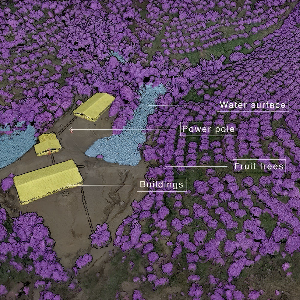
Next-generation reconstruction technology helps create more realistic, high-quality 3D scene outputs.

Capture, Process, Apply

Designed to streamline the route from aerial data capture to usable models, maps, and deliverables.

The world, your digital asset

DJI Terra is a professional 3D reconstruction platform designed to turn drone-captured data into accurate digital assets through a more integrated workflow from capture through processing and application.

Visible-light reconstruction

DJI Terra supports precise and efficient 2D and 3D reconstruction from visible-light imagery for professional mapping and modelling work.

LiDAR data processing

It also supports the processing of data captured with DJI LiDAR systems, helping teams work across more than one sensor type in the same platform.

Integrated DJI workflow

DJI positions Terra as part of a fully integrated hardware-and-software solution for data capture, processing, and application.

Multiple reconstruction methods, one platform

DJI Terra is built around the idea of bringing different reconstruction approaches into one workflow so teams can work more efficiently without fragmenting tools.

3D Gaussian Splatting

DJI highlights next-generation 3D Gaussian Splatting as one of Terra’s defining technologies for more photorealistic scene reconstruction.

Photogrammetry with proven precision

The platform is also positioned around high-accuracy photogrammetry, reinforcing its role in dependable professional survey and modelling workflows.

Built for broader specialist workflows

DJI presents Terra across more than one discipline, showing that it is designed to support a range of professional reconstruction needs rather than a single narrow use case.

Multispectral reconstruction

DJI specifically highlights multispectral reconstruction for agriculture, expanding Terra’s use beyond standard visible-light modelling.

LiDAR reconstruction

LiDAR reconstruction is presented as a core capability, supporting more versatile use across geospatial and inspection-related workflows.

Optimised for larger workloads

DJI also frames Terra around efficiency at scale, helping teams handle bigger jobs with more practical processing performance.

Cluster reconstruction

Cluster reconstruction is highlighted as a way to deliver stronger efficiency when handling larger reconstruction workloads.

A streamlined surveying workflow

DJI says the result is an optimised aerial surveying workflow with maximum efficiency and high precision, reinforcing Terra’s role as an end-to-end production tool.
Disclaimer

All above specs are subject to change by the original manufacturer. Please always consult the actual product’s page on the original manufacturer’s website for up to date information and data notes

Filters

Product Category
Product Category
Brand
Brand
Industry
Industry
Capability
Capability