


Available by enquiry. Contact Incredible Group to discuss configuration and pricing.
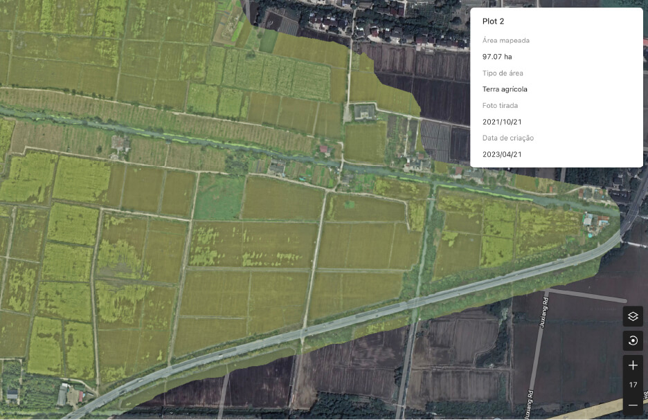
DJI SmartFarm Web is a web-based agriculture platform designed to generate high-definition images of farmland and orchards, analyse crop growth with clarity, and support the digital management of agricultural information. It is positioned as a decision-support tool that helps guide the automated operation of agricultural machinery and monitor operational effectiveness across the field.
Key features
- Digital farming, made clearer Transforms aerial farm data into high-definition field imagery and more structured agricultural information.
- Farmland Image Reconstruction Instantly generates HD images of farmland and orchards for clearer planning and analysis.
- Farmland Planning Automatically identifies field boundaries and parcel areas to support more precise planning.
- Information Archiving Records parcel-level operational information to build organised digital farm-management archives.
- Intelligent Field Scouting Supports field scouting and crop analysis across the plant lifecycle for better-informed decisions.
- Guided Machinery Operations Helps guide automated agricultural machinery and monitor operational effectiveness more clearly.
Digital farming, made clearer
DJI SmartFarm Web is a browser-based agriculture platform designed to turn aerial farm data into clearer field insight, structured planning information, and stronger long-term digital farm management.
Farmland image reconstruction
The platform generates high-definition images of farmland and orchards, helping operators review crop areas more clearly and work from stronger visual information.
Farmland planning
DJI highlights automatic identification of field boundaries and parcel areas to support more precise planning and field organisation.
Information archiving
Parcel-based information archiving helps turn raw aerial results into a more structured digital record for ongoing farm management.
A clearer view of field performance
SmartFarm Web is built not just to display imagery, but to help farms and service teams understand land parcels, crop conditions, and operational activity more effectively.
Field scouting and analysis
DJI presents the platform as a tool for intelligent field scouting and crop analysis across the plant lifecycle.
Crop-growth insight
The system is designed to help users analyse crop growth more clearly, supporting more informed operational decisions in the field.
Built for better agricultural decisions
Beyond imagery alone, SmartFarm Web is positioned as a decision-support layer that helps users move from data collection to practical planning and management.
Cloud-based reconstruction
DJI’s support materials describe SmartFarm Web as a cloud-based platform for reconstructing farmland and orchard imagery into useful visual outputs.
Intelligent route support
The wider platform workflow supports route generation and operational guidance for agricultural machinery and field tasks.
A stronger digital farm workflow
SmartFarm Web is designed to connect imagery, planning, analysis, and field records into one more coherent digital agriculture workflow.
Guided machinery operations
DJI states that the platform helps guide automated agricultural machinery operations and supports monitoring of operational effectiveness.
Long-term farm management
By combining imagery, parcel records, and crop analysis, SmartFarm Web supports more organised long-term digital management of agricultural information.