Monitoring
Wide range of options from on-demand to fully automated
Reduce Risk, Time & Cost
Incredible Group’s commercial drones and CAA Part 102 Certified drone operators vastly reduce the risk
and time involved in inspections, compared to physical inspections. Whether you need regular maintenance,
inspections/surveys, an urgent or emergency response, we have you covered – Incredible Group is on call 24/7
Safe, accurate & cost effective: drone Aerial Inspections & Surveys NZ-wide.
We obtain all Permissions required, e.g. from local authorities & airfields.
- Buildings, Assets, Utilities & Infrastructure
- Thermal Imaging (Thermographic Imaging)
- CAA Part 102 UAV Certification
- Full Aviation & $10M Public Liability Insurance
- 11,900+ Safety Verified logged flights
Accident / Disaster Response
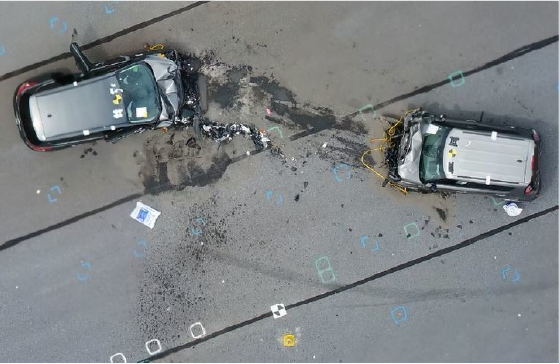
Drones have rapidly emerged as a vital tool for accident and disaster response and prevention. They can quickly map every detail of an accident scene, preserving critical information for later analysis while facilitating faster cleanup and restoring functionality—such as returning road traffic to normal. Deployed within minutes of arrival, drones can begin mapping the location even while first responders are still on the scene, ensuring their efforts remain uninterrupted. An accident scene can typically be mapped in just 10 to 15 minutes. The precision and accuracy of the captured 3D data enable investigators to analyse the scene safely from their offices, providing insurance companies with invaluable information. Traditional methods of describing the scene are often time-consuming and superficial, risking the omission of crucial details that may be lost when cleaning crews rush to reopen the area. In contrast, a detailed 3D model acts as a time capsule, allowing investigators to revisit the scene whenever necessary.
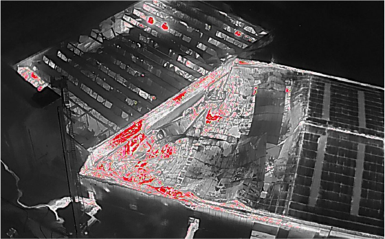
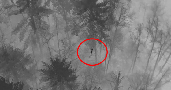
Drones equipped with infrared sensors enhance firefighting efforts by revealing areas of fire concentration, even when obscured by thick smoke or structural barriers. This capability significantly reduces risks for firefighters and improves strategic planning by locating individuals in danger—a task manual searches cannot accomplish as effectively. Drones can provide live feeds to response centres, enabling better coordination of limited resources without interfering with firefighting operations. They can also guide full-sized firefighting aircraft safely to the scene.
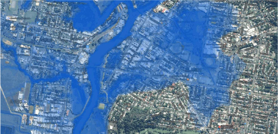
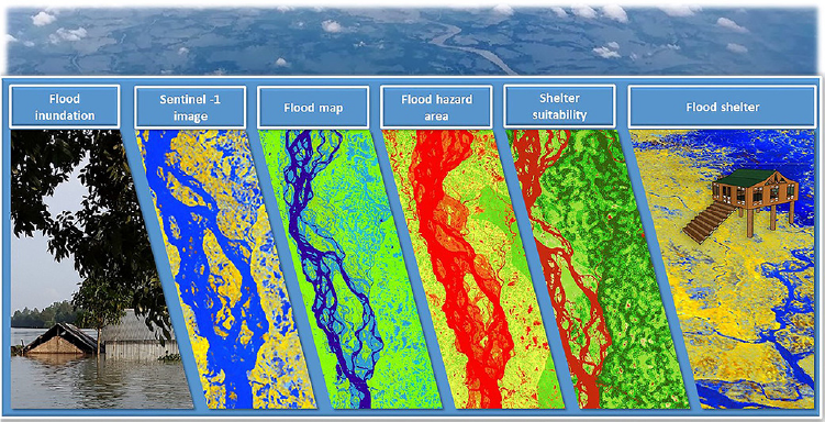
In the aftermath of natural disasters such as floods, earthquakes, or landslides, drones can swiftly generate accurate 3D maps that help responders plan access routes and prioritise their actions, ultimately saving lives. Their ability to quickly reach difficult or inaccessible areas, coupled with live high-resolution imagery, enhances situational awareness. Drones can even deliver emergency supplies or medical assistance rapidly, and remote two-way communication can be established between isolated locations and rescue teams. In addition, they can provide temporary lighting, audio announcements, and wireless signals when needed while continuously monitoring progress and updating location maps in real time.
Drones also play a crucial role in disaster prevention by generating precise 3D elevation maps of at-risk areas for flood risk assessment and advanced response planning. We have created accurate terrain maps to calculate potential lahar flows from active volcanoes. We have identified dangerous areas in hilly regions prone to landslides triggered by heavy rainfall or seismic activity. This information enables ground-strengthening engineering efforts to reduce landslide risks significantly. We have even implemented live monitoring systems in hazardous locations like active volcanoes to provide 24/7 alerts to local residents and response teams.
Moreover, drones can respond to incidents that pose significant risks to rescue personnel, such as nuclear accidents, gas leaks, and fires in facilities storing hazardous materials. Our drones can be equipped with various sensors capable of detecting radiation, gas, or other dangerous chemicals. Unlike human responders, drones can be easily replaced, making even the slightest reduction in risk to personnel invaluable.
Search & Rescue
In search and rescue operations, teams are often pressed for time. Vision Aerial drones can be deployed in under two minutes, significantly faster than helicopters or planes, which require more extensive preparation. Additionally, drones can scan large areas more efficiently with advanced cameras and sensors, surpassing traditional grid search methods. Once a subject is located, GPS coordinates provide search and rescue (SAR) teams with an accurate location.
Drones with thermal and infrared cameras reveal information not visible to the naked eye. Ground teams can use a live stream of thermal images to detect human shapes, and once located, they can switch to a high-resolution camera to assess the condition of the missing person. This helps determine the type of first aid that may be necessary, and the precise GPS coordinates guide rescuers directly to the individual.
While missions involving helicopters and aeroplanes can cost thousands of dollars, drones represent a much more economical option considering their lifespan. Rescuers can remain safely on the ground at the staging area while benefiting from the live imagery provided by the drone.
Search and rescue missions often occur in challenging environments, including remote areas with dense vegetation, cliffs, hills, and ravines. Drones can effortlessly fly over these difficult terrains, covering expansive areas with an autonomous range exceeding 15 kilometres.
Drones significantly reduce the costs associated with traditional search and rescue methods by eliminating the need for expensive manned aircraft, decreasing labour costs, and minimising the time and resources needed for setup and operation. This allows for more frequent and efficient aerial surveillance and better resource allocation during emergencies. With their rapid deployment and quick data collection capabilities, drones provide real-time information and imagery, crucial in time-sensitive situations like search and rescue operations.
Construction Monitoring
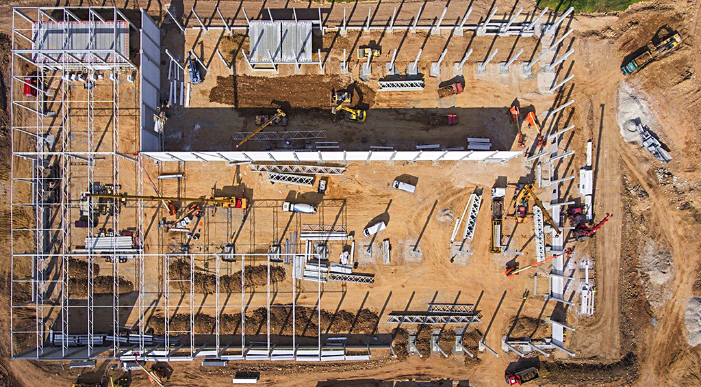
Drones are revolutionising how progress tracking and remote monitoring of construction sites are managed. By generating drone progress reports, construction projects can stay on schedule and within budget. This article explores the benefits of construction progress monitoring and how drones facilitate staying updated on-site activities, even from hundreds of miles away.
Construction progress monitoring involves continuously collecting data throughout a project’s lifecycle to ensure it aligns with planned timelines and goals. This process not only identifies delays but also helps prevent them from occurring. Project managers who regularly collect progress reports can spot issues early and implement solutions before they impact the construction timeline. Progress assessments can be conducted daily, weekly, monthly, or quarterly, depending on project needs and pace. Each evaluation is compiled into a progress report, a valuable resource for documentation, decision-making, and stakeholder communication.
Unlike traditional methods that rely on limited “boots-on-the-ground” perspectives or fragmented information from various teams, a drone flight provides a comprehensive view of the construction site. By capturing aerial footage, drones offer an inclusive overview of the project’s progress, significantly improving conventional progress monitoring techniques.
Drones not only accelerate the surveying process but also reduce labour costs. Advanced drone software further streamlines the compilation of progress reports, allowing for efficient processing and organisation of data into easy-to-read formats. This automation eliminates the time usually required to consolidate information manually, enabling managers to receive real-time updates and reducing the delay in communication regarding site changes.
Drones are particularly effective in inspecting dangerous or challenging areas to access on foot, minimising worker safety risks. Depending on the project timeline, inspections can be conducted weekly, monthly, or even daily. Drones simplify progress comparisons over time by providing consistent perspectives, locations, and altitudes during each inspection. This uniformity enhances productivity and reduces costs.
Furthermore, drone imagery can be shared with project managers, stakeholders, and investors who wish to monitor project developments. Integrating drones into construction workflows can significantly transform operations throughout the bidding, planning, and building phases, leading to more efficient project management and communication.
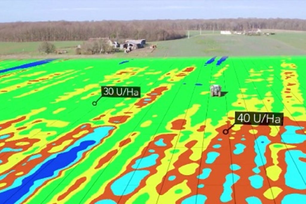
Agriculture Monitoring
Security
Drone surveillance offers real-time insights into security and emergencies, enhancing control, intelligence gathering, situational awareness, and informed decision-making. This technology employs unmanned aerial vehicles (UAVs) to capture still images and videos from a distance or at high altitudes, allowing for monitoring specific targets, whether they are individuals, groups, or environmental areas. The compact size, aerial capabilities, and resilience of drones enable them to access locations that may be difficult to reach, providing perspectives that traditional photographers cannot achieve.
Today, law enforcement agencies increasingly utilise security drones with live video cameras, infrared cameras, thermal sensors, and LiDAR.
Rapid response is critical in emergencies, as every moment can be crucial. Drones significantly enhance this process, performing perimeter patrols up to 30 times faster than manned patrols and delivering feedback within minutes. Surveillance UAVs can operate at high altitudes, offering a broad aerial view without blind spots. With high-resolution cameras, drones can identify anomalies or events even in low-light conditions and from considerable distances.
Using remotely operated drones reduces the risk to security personnel, as pilots can maintain a safe distance. In scenarios involving suspect apprehensions or disaster responses, deploying a drone to assess the situation first can help identify potential risks before humans enter the area.
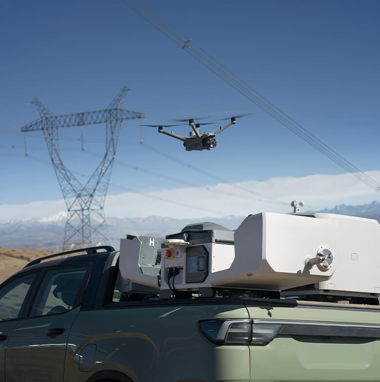
Incredible offers a range of reliable and effective security and surveillance drones tailored to meet diverse needs. These drones can carry various payloads and exhibit different endurance levels, making them suitable for monitoring large areas, navigating challenging terrains, and operating under adverse weather conditions. Our innovative dock system enhances the capabilities of these drones, allowing for automated takeoffs, landings, and recharging, ensuring they are always mission-ready. This docking system facilitates seamless deployment and recovery, enabling continuous monitoring without human intervention.
Regardless of your specific requirements—whether dealing with steep slopes, significant altitude variations, or the absence of suitable take-off and landing surfaces—Incredible security drones are equipped to handle these challenges. Please contact us with your unique needs; we will provide the most appropriate solution.