Incredible Group UAV Expo 2026 at Eden Park

On 20 May we brought New Zealand’s commercial UAV industry together at Eden Park for the inaugural Incredible Group UAV Expo. It was an invite only showcase built around one idea: show what enterprise UAV technology actually does in the field, not on a stand. Across the day we ran live demonstrations, hands on displays, and short talks spanning inspection, security, mapping, heavy lift, cleaning, remote operations, compliance, and insurance.

The room was the right one. Asset owners, operators, and decision makers from inspection, security, infrastructure, surveying, and facilities management spent the day with the platforms, payloads, and software they are weighing up for their own operations. Partners on the floor included DJI Enterprise, FlyFreely, SPS Automation, Lucid Bots, Provision, Highr, ICOM, UAV Insure, SGS, Flyability, CZI, and the Civil Aviation Authority of New Zealand.

For the wider industry, the value was in seeing the whole picture in one place. Real platforms, real workflows, and the standards that sit behind professional operations, all running live with the people who actually deploy them.

Capturing Eden Park in 3D: Point Cloud, Mesh, and Gaussian Splat

Prior to the live demonstrations, we captured Eden Park itself in full 3D. Two complementary workflows gave us the models that the rest of the day was built on.

The first was a LiDAR point cloud, flown with the DJI Matrice 400 carrying the Zenmuse L3 LiDAR payload. We combined nadir, oblique, and manual scanning passes to get complete coverage of the stadium, including the overhangs and undersides a single pass would miss. The result is a high density point cloud with cm level accuracy, the kind of dataset that supports precise measurement, volumetric analysis, and proper infrastructure documentation.

The second workflow was photogrammetric, flown with the DJI Matrice 4E. Using Smart Oblique and manual scanning, we produced both a 3D mesh and a Gaussian splat model of the venue. That output is about visualisation: photorealistic detail, virtual flythroughs, and spatial data you can put straight in front of a client without a technical translation layer.

Run together, LiDAR and photogrammetry give you the best of both. You get measurable, survey grade geometry from the point cloud and a photorealistic model anyone can navigate, which is exactly what teams managing large scale assets need when they want to inspect, plan, and report without going back to site.

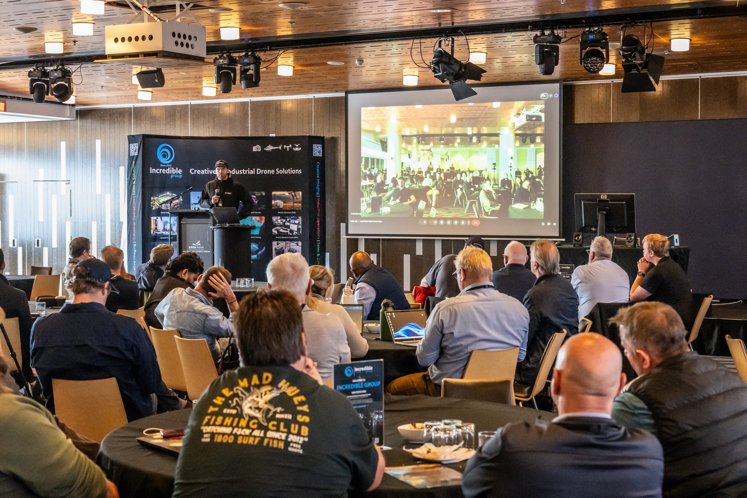
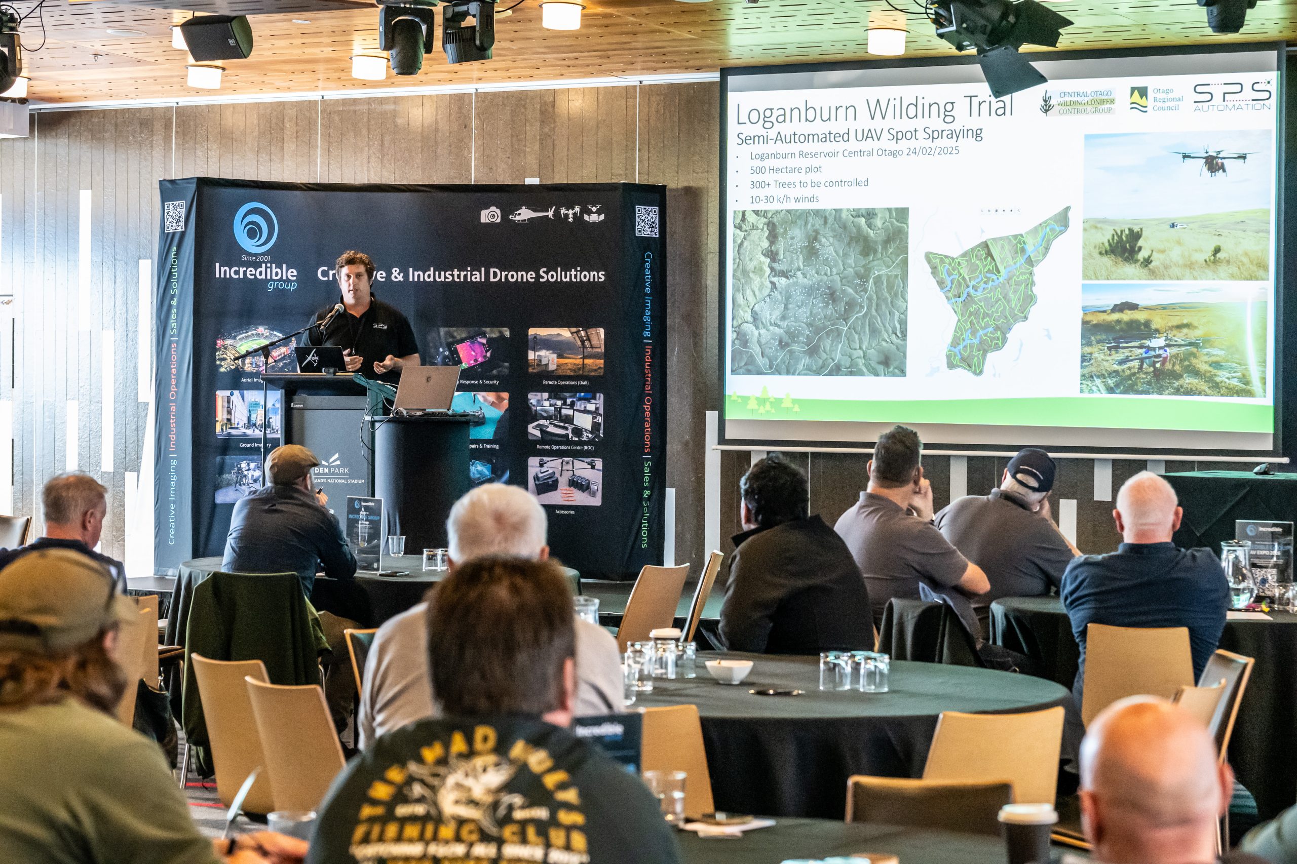
Demonstrations and Highlights

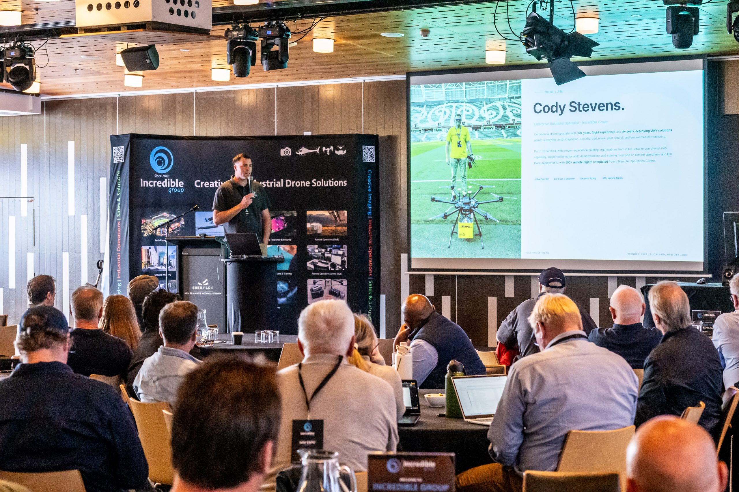
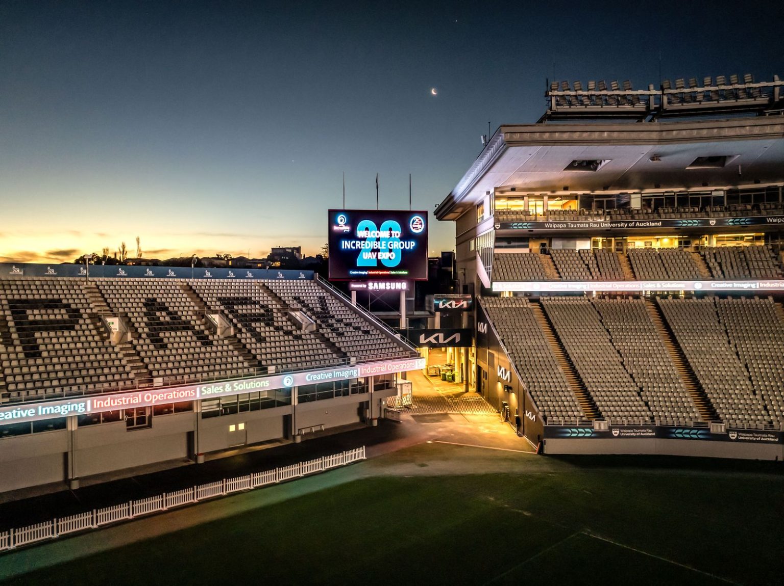
DJI Dock 3 at Eden Park: Autonomous Inspection in Action

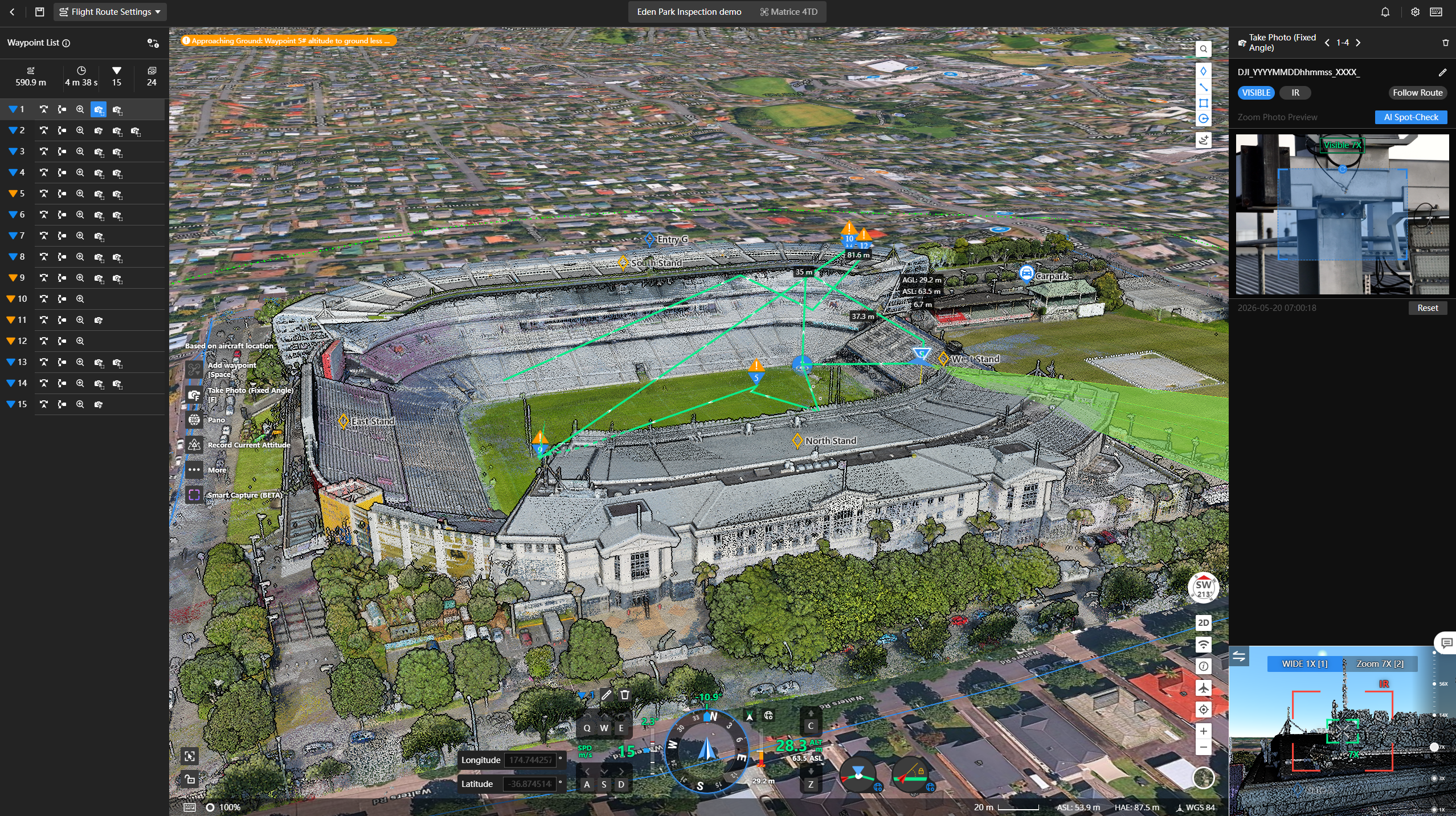
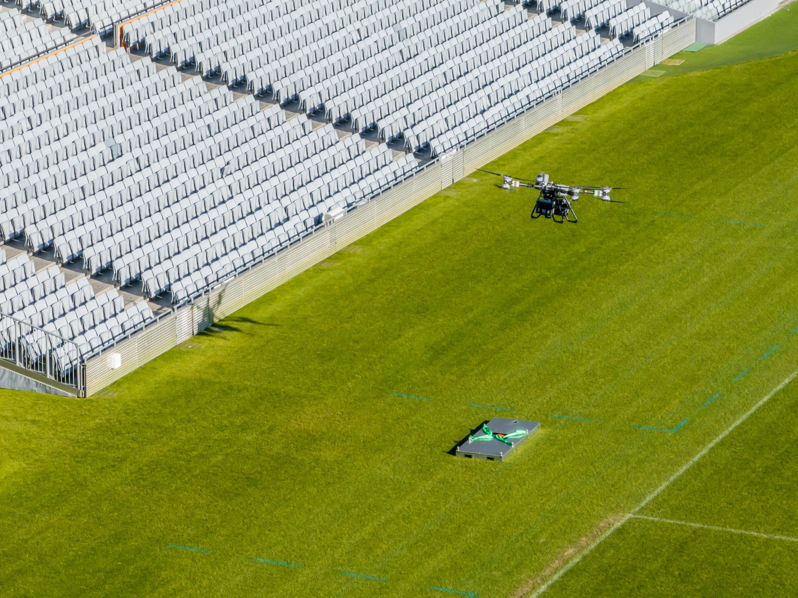
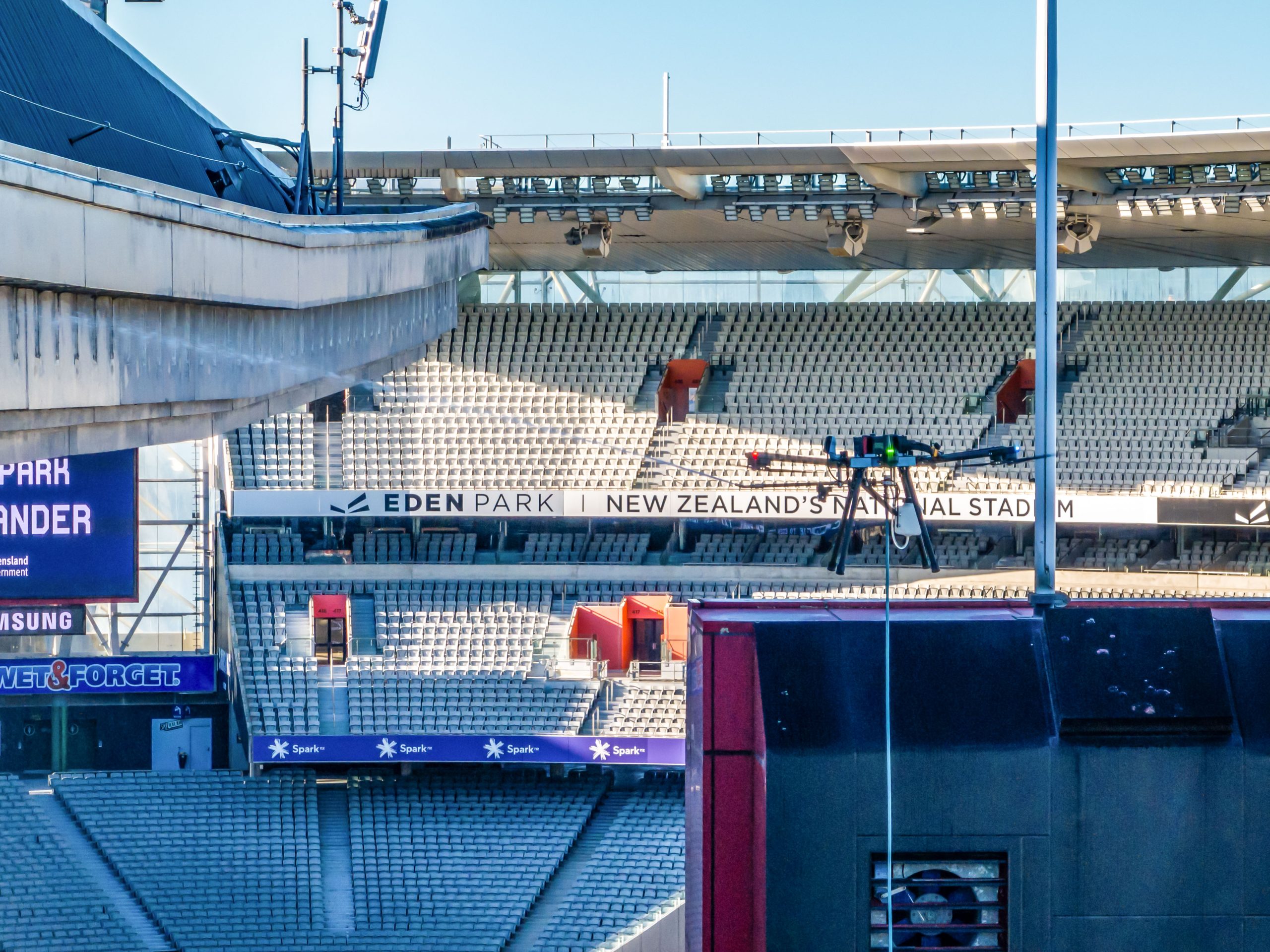
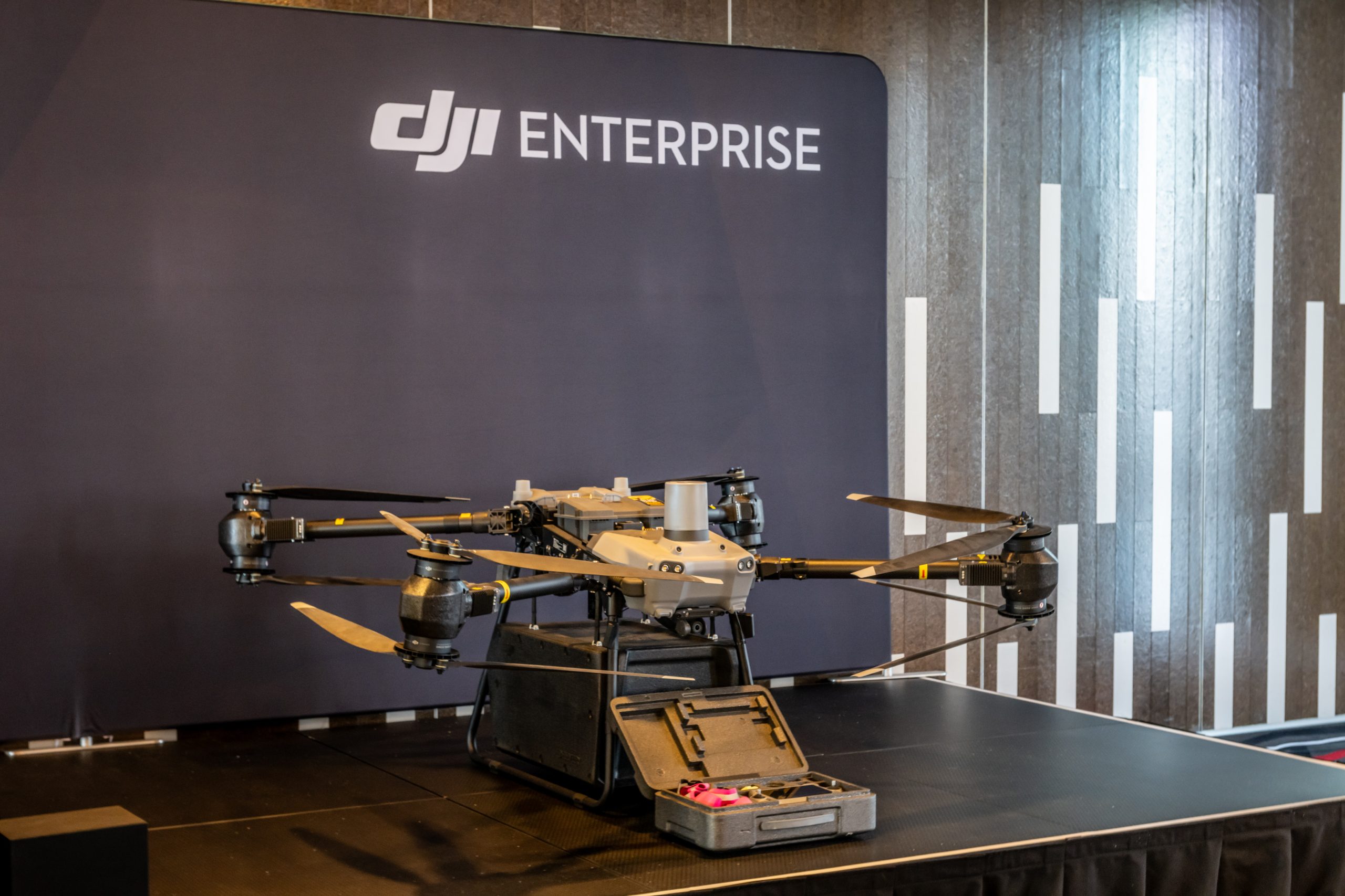
One of the headline demonstrations was our DJI Dock 3, running live inspection and patrol workflows over the stadium and led by Cody Stevens in the afternoon remote operations session. It put autonomous drone inspections, run in real New Zealand conditions, in front of the room, from planning through to capture.

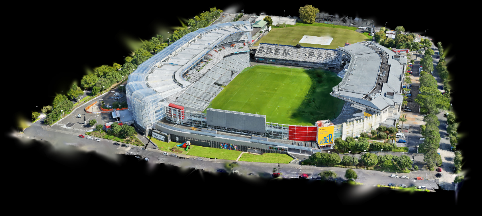
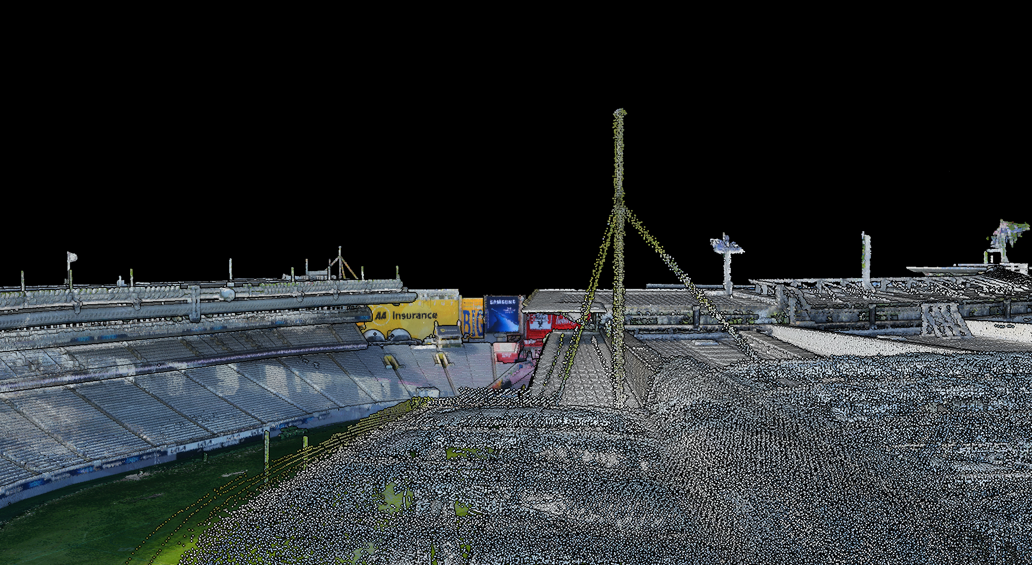
We built this flight path in Flight Hub 2 to demonstrate the Dock 3’s inspection capabilities, with the waypoint mission constructed directly inside the Eden Park model we captured earlier. Because the model was captured at cm level accuracy using RTK, every waypoint sits exactly where the drone will position itself in flight. That let us virtually fly around the stadium beforehand and pinpoint precisely what we wanted to photograph.

Using the Matrice 4TD’s high resolution zoom cameras, we captured imagery right down to the nuts and bolts of the infrastructure. It gave attendees a strong real world use case, showing both the efficiency of remote drone operations and the significant safety benefits. Inspections like these can now be completed without putting people in hazardous positions involving scaffolding, rope access, or working at height.

Flight Hub 2 waypoint mission overlaid on the 3D stadium model
Matrice 4TD in flight at Eden Park
High resolution zoom capture of stadium infrastructure detail

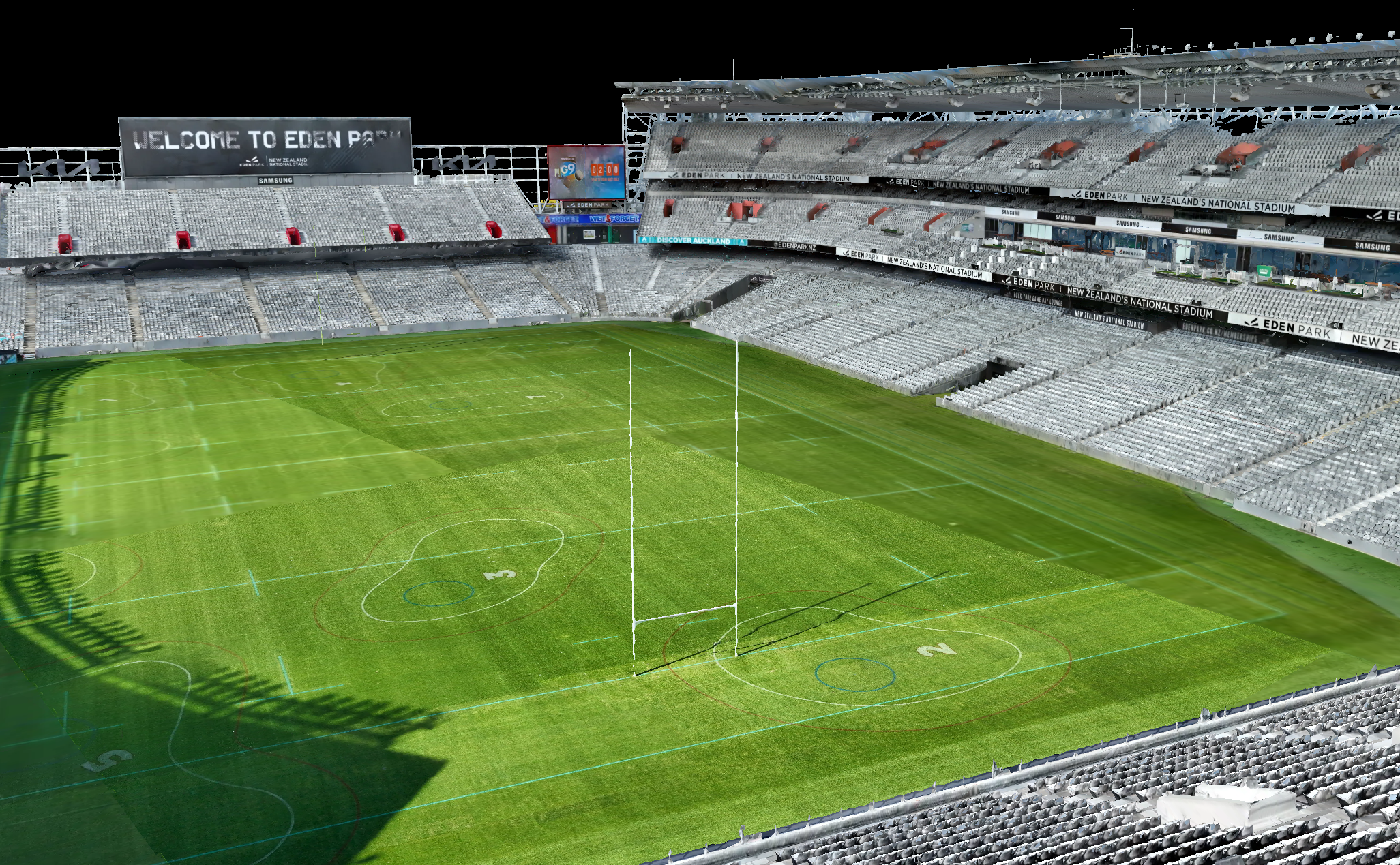
The same Eden Park model also let us put Flight Hub 2’s measurement tools to work, turning a single flight into survey grade data with no manual processing in between.

We used the Eden Park model to take survey grade measurements of the pitch through Flight Hub 2’s automated workflow and analyser. The football field should measure 105m long by 68m wide, and we’ll let the images below do the talking. Multiplying those out gives a pitch area of 7,140m².

We then calculated the gradient and slope angles. The pitch is built to slope to all sides from the centre, and the measurements showed us exactly that. Flight Hub 2 ran the whole process from deployment to PDF report without anyone touching a thing: the drone deployed, mapped the park, landed, uploaded the data, built a 2D orthomosaic in the cloud, ran the pitch measurements, and generated a full report.

View the full Eden Park pitch report (PDF)

AI Detection on an Autonomous Patrol Route

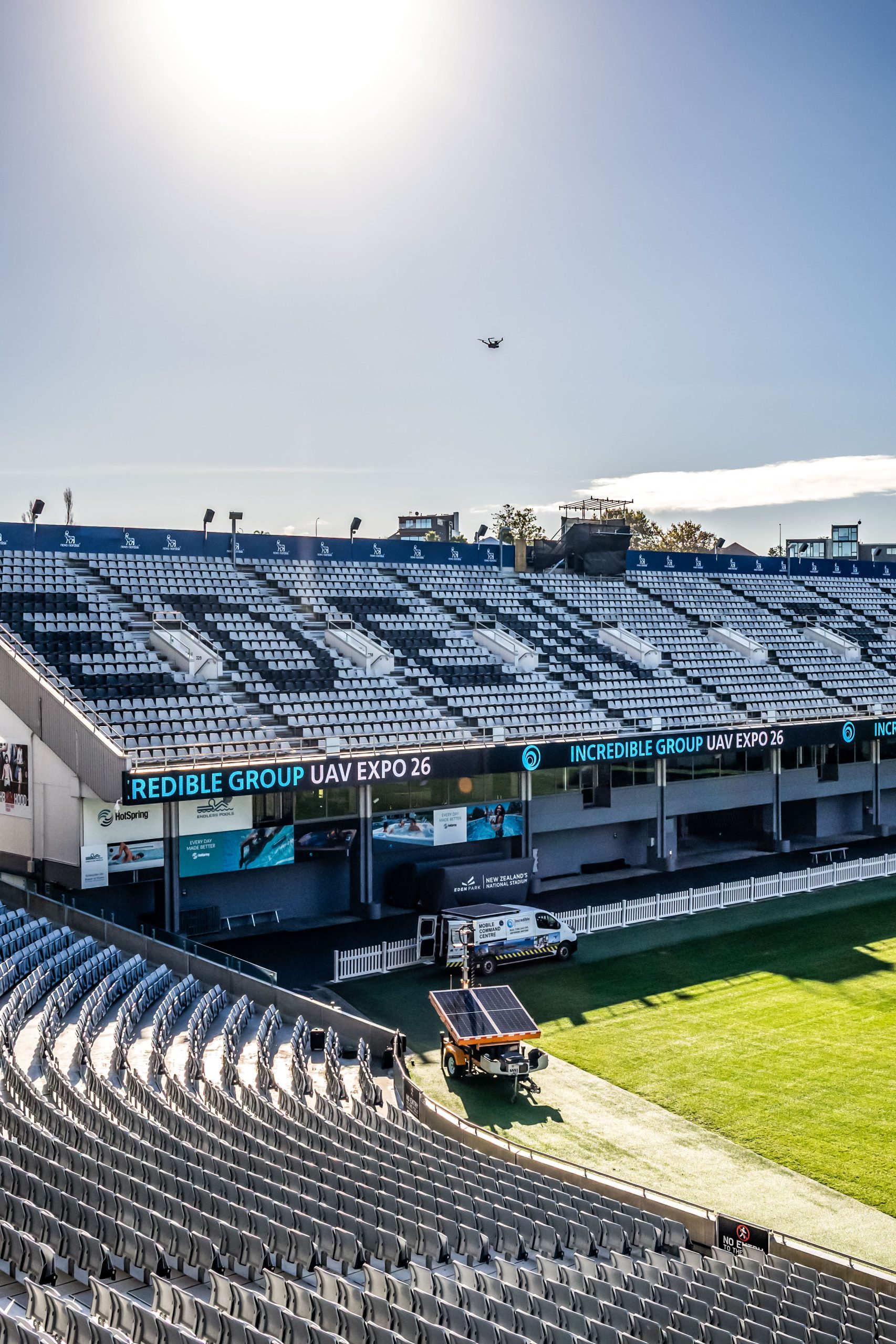
We captured this during an autonomous patrol run on the morning of the expo.

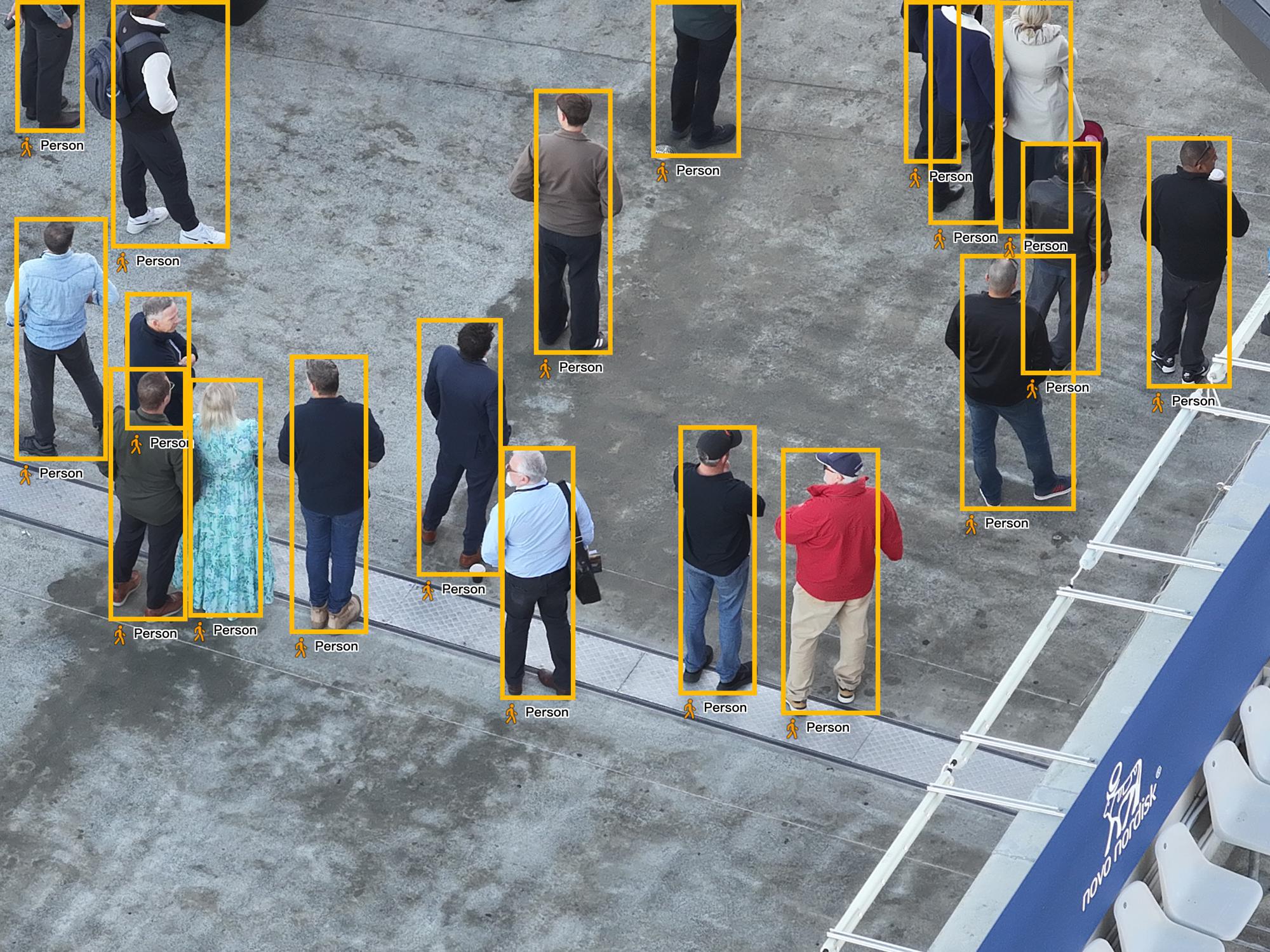
Using the Matrice 4TD’s built in AI detection, we ran the drone along a patrol route while the onboard AI flagged people in real time. As it flew the route, each time a person was detected the aircraft zoomed in on the target and captured a photo. The same detection works through the thermal sensor and can pick up cars and boats, which is changing the game in fields like search and rescue and security.

AI detection in action: Matrice 4TD autonomous patrol flagging people with automatic zoom and photo capture.

AI detection snapshot of the Matrice 4TD flagging a human target during patrol

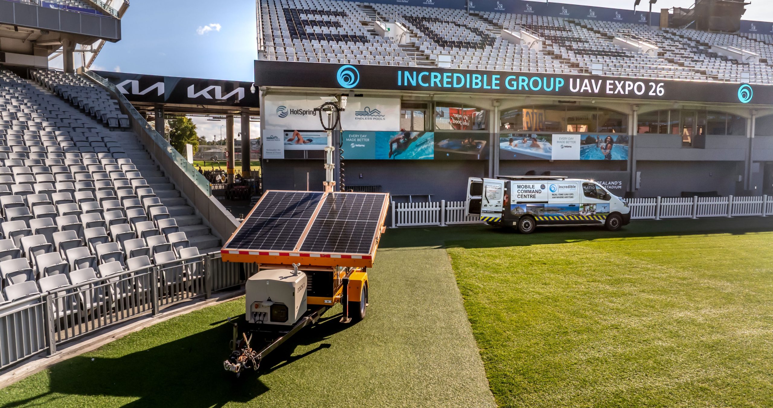
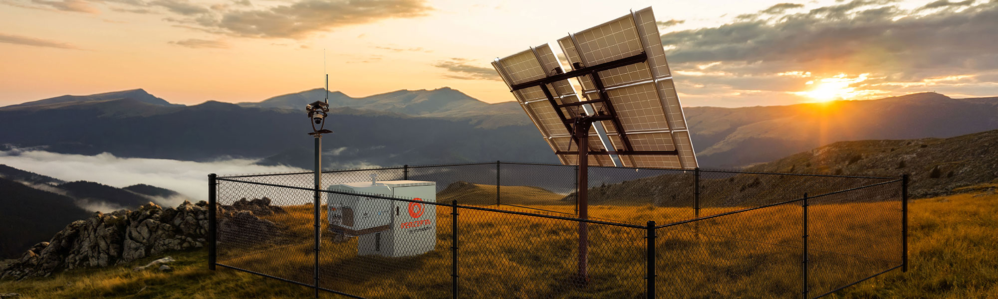
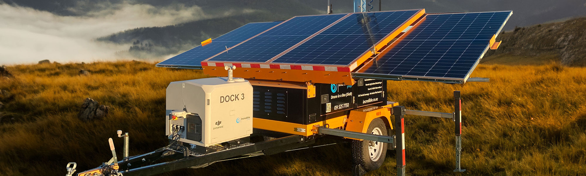
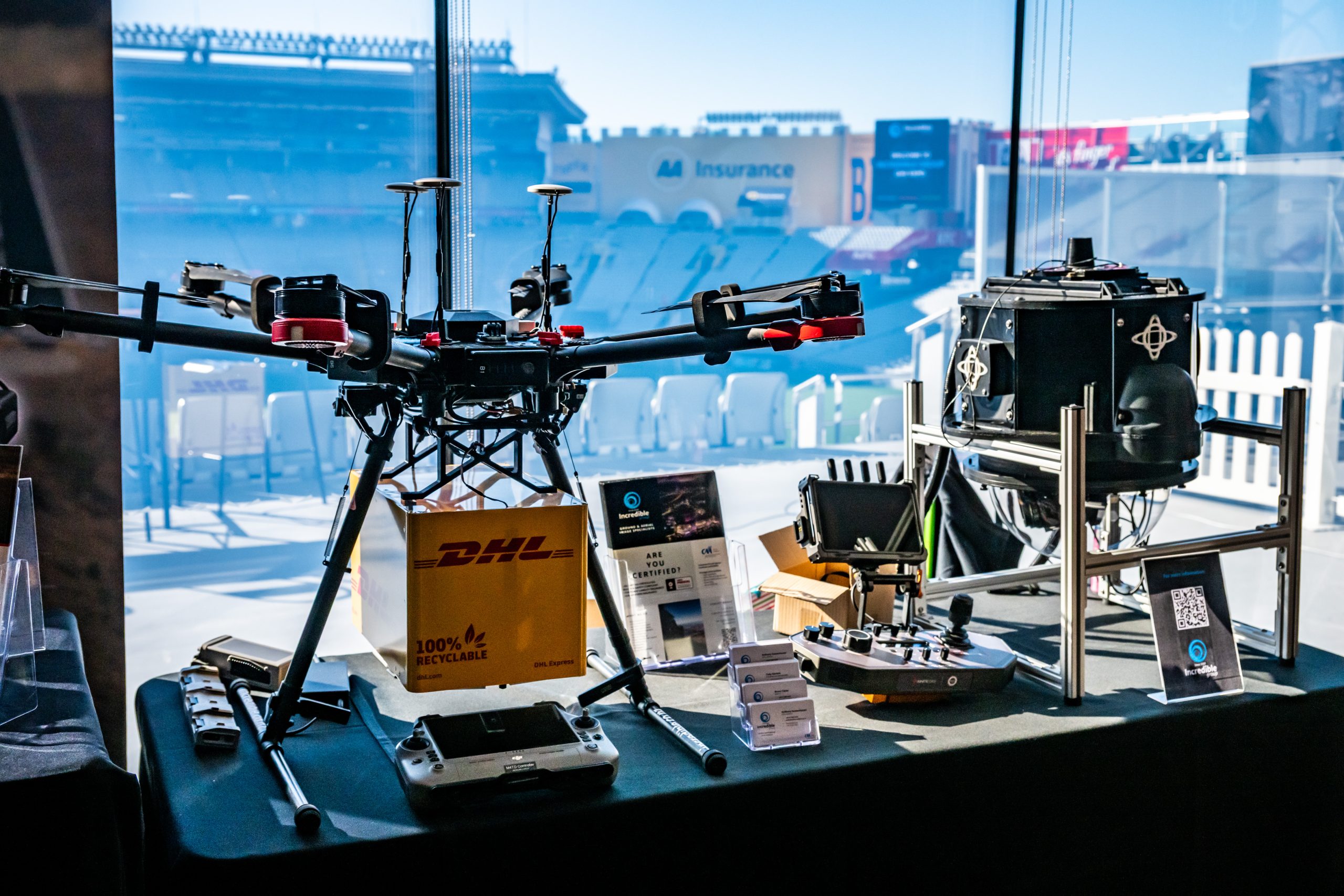
PERCEPTA: Site Awareness for Remote Operations

Running a drone in a box site remotely means trusting what you can see from somewhere else. PERCEPTA is our answer to that problem. It is an in house site awareness system, hardware and software, built by Incredible Group’s own engineering team off the back of real aviation and aerospace experience and a lot of operational hours.

The idea is simple. An operator overseeing a remote site should be able to read conditions quickly and confidently, without digging through five different screens.

PERCEPTA pulls the inputs that matter into one interface: live visual monitoring, ADS-B traffic, weather, communications status, and power status, alongside other key site feeds. That is the point of Percepta remote operations, less noise, faster decisions, and attention kept on the work that matters.

It comes in fixed and mobile configurations, so it suits a permanent installation or a site that moves with the job. We originally designed it around the DJI Dock 3 paired with the Matrice 4D or 4TD, and it sits in that deployment stack as the awareness layer over the dock. It is also built to scale, ready to support other brands and future drone in a box platforms as fleets grow.

PERCEPTA in a fixed site deployment
PERCEPTA installed alongside a DJI Dock 3 on a mobile drone in a box rig

Download the PERCEPTA brochure (PDF)

Beyond our own demonstrations, the day ran on the people doing this work. Here is every session, in order.

Lucid Bots: The Manufacturer Behind the Sherpa Wash Drone

We were lucky enough to call through to Lucid Bots, based in the United States and the manufacturer of the Sherpa wash drone. Putting the manufacturer right in front of the room gave great insight into where the wash drone technology, and the industry around it, is heading.

Real World Wash Drone Operations, with Brad Oberman, Highr Group

The day actually started outside with a live drone wash demonstration, and Brad picked it up on stage. As a real world wash drone operator running the Lucid Bots Sherpa here in New Zealand, he gave the room the operator’s view: what the platform is like to run day to day, and where it earns its keep. For anyone maintaining tall or awkward structures, the case writes itself: faster cleans and fewer people at height.

Brad Oberman presenting on real world wash drone operations

Navigating UAV Compliance and Regulation, with Cody Stevens

Cody took on the part of commercial drone work that quietly makes or breaks an operation: staying compliant under New Zealand’s UAV rules while running complex and autonomous flights. For anyone scaling into drone in a box, this is the groundwork that has to be right before anything leaves the dock.

Cody Stevens presenting on UAV compliance and regulation

The Future of Commercial Drone Operations in NZ, with Tom Goodwin, DJI Enterprise

Tom brought the DJI Enterprise distributor’s view on where commercial drone operations are heading here, and what the platform roadmap means for local operators. The reminder landed: hardware decisions and operational decisions have to move together.

Tom Goodwin presenting on the future of commercial drone operations

Managing Drone Teams and Approvals With Software, with Carlos Hofmann, FlyFreely

Carlos showed how FlyFreely takes the admin pain out of running a drone team, pulling mission approvals, compliance records, and fleet coordination into one place instead of scattered spreadsheets and inboxes. Once you are past a couple of pilots, that kind of system stops being a nice to have and becomes the thing that keeps you flying.

Carlos Hofmann presenting FlyFreely software

The Ins and Outs of UAV Insurance, with Richard Longley, UAV Insure

Richard covered the side of the industry nobody thinks about until they need it, walking through how UAV cover actually works and where operators get caught out, from policy gaps to insuring autonomous and beyond line of sight work. For asset owners weighing up commercial UAV operations, getting insurance right is simply part of doing it properly.

Richard Longley presenting on UAV insurance

Flyability Elios 3: Confined Space Inspection, demonstrated by SGS

Jack from SGS put the Flyability Elios 3 through its paces, a confined space inspection drone built to safely inspect, map, and capture data inside hazardous, GPS denied environments like tanks, tunnels, mines, and industrial assets. It pairs collision tolerant design with LiDAR and high resolution imaging to pull visual and 3D inspection data without sending people into dangerous spaces.

Flyability Elios 3 confined space inspection demonstration

New Zealand Built AI Robotics and Automation, with Scott Spooner, SPS Automation

Scott made the case for homegrown technology, showcasing New Zealand built AI robotics and automation from SPS Automation. For a room full of operators, it was a strong signal that real, competitive capability is being built right here in New Zealand.

Scott Spooner presenting for SPS Automation

DJI FlyCart 100 Heavy Lift Live Demonstration

We had Khan from Provision run a live demonstration with the DJI FlyCart 100. Heavy lift operations are evolving fast, and the FC100’s 100kg payload capability shows where this is going. For demonstration purposes we lifted our own 70kg PERCEPTA platform.

DJI FlyCart 100 lifting the 70kg PERCEPTA platform

Where the Commercial UAV Industry Is Heading

A few things stood out, and they are the same things we see on client sites every week.

Remote UAV operations in New Zealand have moved from demo to deployment. The questions at Eden Park were not about whether the technology works, but how quickly it can be deployed and how much more efficient it can make day to day operations.

Infrastructure work is becoming a data problem more than a flying problem. Clients no longer want photos, they want measurable datasets and reports that drop straight into their asset management systems. The aircraft is just the sensor platform now, and the value sits in what comes off it.

Thermal and AI workflows have stopped being specialist extras. Onboard detection, thermal payloads, and automated analysis are turning up in ordinary inspection and security jobs, not only the exotic ones.

Drone in a box adoption here is moving quicker than most people outside the sector realise. The operators who adopt now will be the ones winning later.

Thanks to Everyone Who Made the Day Happen

A day like this only works because of the people who show up for it. Thank you to Eden Park for hosting us in a venue that let us actually fly, not just talk about flying.

Thank you to our partners and presenters: DJI Enterprise, FlyFreely, SPS Automation, Lucid Bots, Provision, Highr, ICOM, UAV Insure, SGS, Flyability, CZI, and the Civil Aviation Authority of New Zealand. And thank you to everyone who walked through the doors, asked sharp questions, and made the conversations worth having.

Thanks to Everyone Who Made the Day Happen

If you want the feel of the day rather than the detail, start here. This is the whole event condensed into a 90 second highlight reel, from the first flight to the last handshake.

Other Images From the Day

A few more shots from around the floor. Click through to see the day from a few more angles.

Where to From Here

If anything on the day got you thinking about your own operation, let’s talk. Tell us the problem you need to tackle and we’ll recommend the best approach, anywhere from manual operations run in house through to fully remote operations with PERCEPTA.

If remote drone in a box operations are on your radar, get in touch and we’ll discuss demo options on your own site.

About Incredible Group

Incredible Group is an Auckland based DJI Enterprise reseller and managed UAV services provider, certified under New Zealand’s Part 102. We run a dedicated remote operations centre and deliver full end to end drone packages, from hardware and payloads through to managed, drone as a service operations. NZ operators trust us because we fly what we sell and stay with it long after the sale.

Incredible Group, approved DJI Enterprise reseller and managed UAV services provider

Filters

Product Category
Product Category
Brand
Brand
Industry
Industry
Capability
Capability